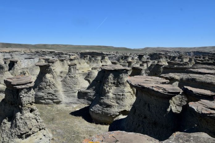
Rock City, Montana, felt like a hidden treasure, and we weren’t quite sure if we were trespassing. Slowly driving along the dirt path with the fence line on one side and wheat fields on the other, the rolling landscape was a sea of green with the Rocky Mountains standing in the distance to the west. After just over two miles, the area changed as we left the civilized fields and stepped into an otherworldly space. We had found Rock City!
Exploring the Hoodoos and Mushroom Rocks of Rock City, Montana
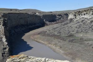
Rock City is an oasis holding this geological wonder, mostly known only to locals. It is surrounded by agricultural fields to the east, west, and south, to its north, the Two Medicine River, which continues to carve this landscape, borders the Blackfeet reservation, which continues north, and Cut Bank Creek is the eastern boundary.
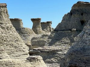
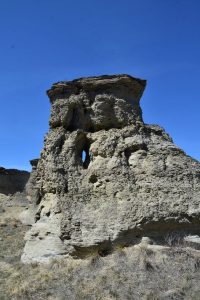
Made up of roughly 140 acres of Montana Department of Natural Resources and Conservation (DNRC) land, visitors to Rock City, Montana, can walk through the hundreds of rock pillars called hoodoos and “mushroom rocks” that tell the geological story of this region. These weathered rocks stand between three and 20 feet tall. Some feature crevices or cave-like structures worn through them and beckon us to look deeper into what these layers of sandstone tell us about the area.
Rock City, Montana, and the Western Interior Seaway
“Right at Rock City, if you look at the rocks, you are literally at the edge of the Western Interior Seaway,” explains Ray Rogers, professor of geology at Macalester College in Saint Paul, Minnesota. Immersing himself for decades within the Cretaceous Geology of Montana, Rogers explains the significance of Rock City, Montana. “It marks the boundary between ancient marine and terrestrial worlds.”
The story begins over 80 million years ago during the Cretaceous Period, when this area was part of a giant basin. The Rockies were being formed by periods of dramatic and sometimes violent uplift and volcanic activity, while at the same time, Rogers noted, “The crust was being pushed down by the massive mountains building to the west.”
But there were also other geological factors impacting the environment. “There was much less ice on the earth at the time,” he says. With the global sea level significantly higher, and as a result of the sinking terrain, waters stretching from the Arctic Ocean to the Gulf of Mexico inundated the ancient Montana landscape, creating the Western Interior Sea that was nearly 3000 feet deep at its deepest point.
Life in the Ancient Western Interior Sea
During this time, the climate was also much warmer with higher humidity. Lush vegetation supported an abundance of life, including the well-known Montana herbivore dinosaur Maiasaura, along with the predatory cousins of the well-known Tyrannosaurus rex and Deinonychus, a larger relative of the movie-famous Velociraptor. The Two Medicine Formation is globally renowned for its fantastic dinosaur fossils.
Standing in the distinctly arid landscape of this current age, it’s difficult to imagine looking over this area and envisioning it as a sea teeming with life. Granted, at the bottom of this area, the Two Medicine River and Birch Creek offer up trout to anglers, but at that time, the aquatic reptile, Mosasaurus, along with over 20 species of sharks, including the 26-foot-long Cretoxyrhina, cruised the deep waters. These predators hunted animals within the sea, as well as along the shore and even in the air, as at least one fossil of a pterosaur has teeth marks indicative of it being grabbed while flying above the seaway.
Wildlife on the Montana Prairie
During our visit, our concern and interest as far as wildlife goes was of much smaller creatures. Even though we’re on the prairie, this is the home of grizzly bears that are reinhabiting their traditional range. When the Lewis and Clark Expedition came through the Dakotas and Montana, they encountered their first grizzly at the North Dakota border and experienced run-ins all along the Plains. After decades of conservation efforts, grizzlies are making a comeback and returning to the prairie, which means we need to walk with our eyes wide open.
This is even more true of rattlesnakes that hunt and live among the hoodoos. As soon as the weather warms in the spring and well into the autumn, watch your step and be careful of grabbing a rock before making sure a rattlesnake isn’t curled up to escape the heat. Bull snakes also reside in this area. While they might look similar, bull snakes have a narrow head with a thicker neck, and rattlesnakes have a triangular-shaped head that narrows down at the neck. Plus, even though bull snakes mimic the buzz of a rattlesnake very well, they don’t have the rattle at the end of their tails. Bull snakes are also not venomous. Either way, just keep your eyes open, and please do not harm any of them.
Two Medicine River Geology and Sandstone Formations
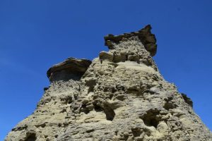
Standing on top of one of the hoodoos, it’s easy to gain a better perspective of this unique area and how it was formed. Rogers says that at the very bottom down near the Two Medicine River, is the Telegraph Creek Formation, which consists of layers of fine-grained sandstone and shale. This formation was deposited in deeper waters than the rocks above.
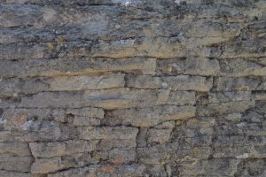
“The Virgelle Formation forms the prominent cliffs at Rock City,” points out Rogers. This is predominantly a shallow marine and beach sandstone deposit that is found not only at Rock City, Montana, but also running south to Priest Butte south of Choteau, as well as along the Missouri River between Coal Banks and Judith Landing, well over 100 miles away. In central and eastern Montana, the Virgelle is part of the Eagle Formation. Understanding the scope of this formation puts the size of the seaway in perspective. Walking through the hoodoos, geological history is at our fingertips. We touch the wavy layers of sandstone deposited over 80 million years ago in the inland sea. Referred to as hummocky and swaley bedding, the patterns in the rock give us a clue into the depth of the water and the storm waves that impacted the seafloor. Large waves carved hummocks and swales upon the seafloor.
Ancient Beaches of the Western Interior Seaway
Sandstone deposits at the very top of the cliffs were deposited on the ancient beaches along the edge of the seaway. “Heavy mineral lags are preserved at the top of the Virgelle Formation,” says Rogers. “When waves washed across the beach, the lighter minerals were swept offshore and the heavier minerals were left concentrated on the beach.”
These beach placer deposits explain the presence of the heavy, dark-colored beds that cap many of the mushroom-shaped formations. Rogers points out that when we visit a beach today, we might notice little black lines in the swash zone. “These are often remnant lags of heavy minerals. When you look at Rock City, you’ll see orange coloration that represents the oxidized remnants of these minerals,” he says.
Depending on the concentration of iron within the sandstone, sometimes a magnet will be attracted to the rock and stick. The kids love this.
How Montana’s Hoodoos Were Formed
Toward the end of the Cretaceous Period, roughly 70 million years ago, the Western Interior Seaway slowly drained from the continent.
“The appearance of how Rock City looks now is a reflection of weathering and erosion that has taken thousands of years,” says Rogers. “Wind and water sculpt the land now.” The Two Medicine River continues to carve its path through the landscape, and the combination of rain and wind shapes the hoodoos.
Definitely off the beaten path, it’s an adventure to visit Rock City. “I rarely see people at Rock City or on the Two Medicine River,” Rogers says. “There’s no public land to my knowledge in this area except Rock City.”
But it’s a worthwhile excursion to step back in time to stroll among the layers deposited when the dinosaurs walked this landscape and appreciate the beauty that surrounds us to this day.
How to Visit Rock City, Montana
Only 9.2 miles north of the small community of Valier, it doesn’t take long to reach Rock City, Montana, but it’s important to understand not to attempt it if it has recently rained or rain is in the forecast. The last 2.4 miles travel along the dirt road, and when wet, the resulting gumbo is impassable, even with a four-wheel drive vehicle. I also wouldn’t attempt the drive in a low-profile vehicle, as the ground is uneven and might cause significant damage. There’s typically no cell service in this area, as well, so calling for help might require a several-mile walk.
To find Rock City, turn north on Cutbank Highway at the only stoplight in town. Just shy of three miles along the paved road curves, but continue straight on Rock City Road, which is gravel. There are roughly four miles of this gravel road, and when it runs out, keep going straight (north) on the dirt road. It’s impossible to miss Rock City.
There is a large parking area at Rock City with an informational sign, but there is no restroom facility. Please stop at the gas station, or one of the coffee shops or restaurants in Valier, before venturing out to the land, because nobody wants to see toilet paper among these geological wonders.
This story about Rock City, Montana, previously appeared in Rock & Gem magazine. Click here to subscribe. Story and photos by Amy Grisak.


